R3,000 - R4,000
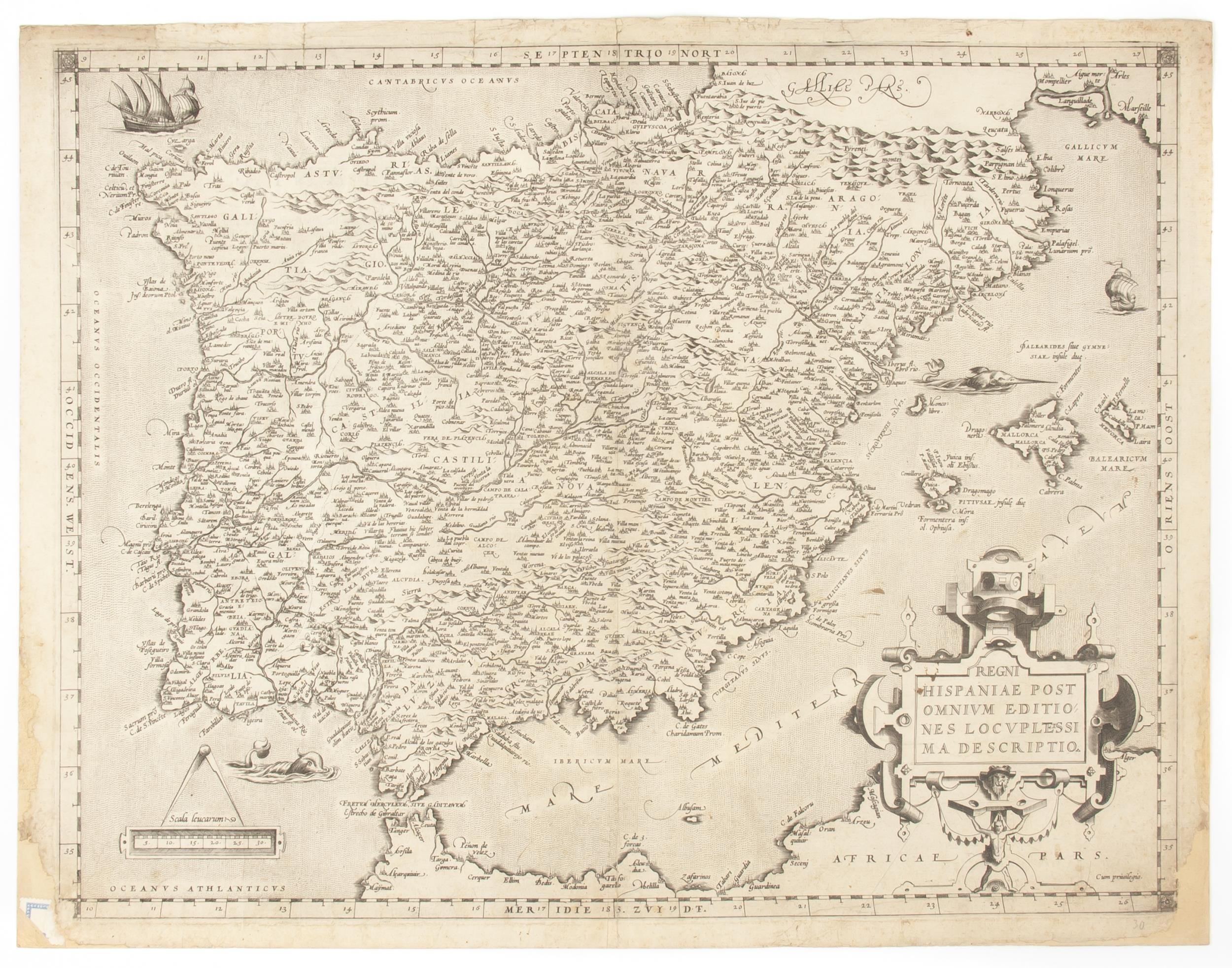
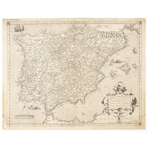
Abraham Ortelius - REGNI HISPANIAE POST OMNIVM EDITIONES LOCVPLESSIMA DESCRIPTIO
Uncoloured copperplate engraving. Centre fold. Latin text on verso.
Image 38 x 48, on sheet 40,5 x 53cm
Map of the Spanish Kingdom, including Portugal (united to Spain between 1580 and 1640), from the “Theatrum Orbis Terrarum,” first published by Abraham Ortelius in Antwerp in 1570, after the map of the botanist Carolus Clusius, also known as Charles de l'Escluse, who published a six-sheet map of Spain, “Hispaniae Nova Descriptio”. The map is centered around the peninsula itself, including the Balearic Islands, and with a sliver of Northern Africa to the south. The interior of the peninsula is littered with place names, each noted with a building symbol, rivers and mountains. Ortelius’ characteristic strapwork design ornaments the title cartouche at the lower right corner. In the lower left corner is a scale, which is topped with a large pair of dividers. A swordfish faces the Balearic Islands, while another sea monster approaches the Strait of Gibraltar from the west. In the upper left corner is a ship in full sail, with another to the right side of the map.
This map appeared in four states, although it was altered relatively little over the course of its publishing history, which lasted from 1570 to 1612 with regard to Ortelius’ atlas.
• The first state appeared in the first of Ortelius’ atlases in 1570.
• The second state, used from 1573 onward, replaces the name Paracuelos with Martimuñoz.
• The third state, from 1589, added several place names and changed “Fretum Herculeum, sive Gaditanem/Estrecho de Gibraltar” to merely “Estrecho de Gibraltar.”
• The fourth state added stippling around the names of the seas and extended the hachuring along the coastlines. It appeared from 1595.
This copy appears to be either the third or fourth state.
Abraham Ortelius (1527 –1598) was an Antwerp based cartographer best known for the publication in 1570 of the first modern atlas, the “Theatrum Orbis Terrarum,” covering the contemporary cartographic knowledge. He personally drew the maps, which were then engraved by Ambrosius and Ferdinand Arsenius and Frans Hogenberg. The atlas was published between 1570 and 1612 in 31 editions, with text in Latin, Dutch, French, German, Italian, Spanish, and English, the 1570 edition having 70 maps on 53 sheets, and the 1612 edition having 167. After Ortelius's death the copper plates passed to his heirs, then in 1601 sold to Jan Baptist Vrients which added new maps and published the atlas until his death in 1612. Later the plates were sold to the Moretus brothers, successors of Christoffel Plantin, and some maps published until 1640.
Condition: Good. Small sections of bottom corners and sides are missing, and small sectons of the map are also missing at the bottom corners and sides. Small sticker to bottom left-hand corner, and small note in pencil to bottom right-hand corner. Slight discolouration, and a few small spots of wrinkling, small stains and foxing to map. Small closed tears to top edge of map. A few repairs to verso. Map has been professionally mounted.
Fees apply to the hammer price:
Room and Absentee Bids:| 1 to 10000: | 23% inc VAT* |
| 10001+: | 19.55% inc VAT* |
| 1 to 10000: | 23% inc VAT* |
| 10001+: | 19.55% inc VAT* |